Day 35: Mercer to Rangiriri
Distance Covered: 26 km
The big news to start the day was a hiker dropping. The gentleman who had dropped before Auckland and then reconsidered after a few days off dropped again. We said in yesterday’s post how rough mentally the trail was to Mercer. He agreed (independently) and felt that he’d had enough of it all. He’s going to do some section hiking of good trails in the north and south instead. He’s done quite a bit around the country before doing the TA. He assures us that we will nearly cry for joy when we see the good stuff.
For our part, we felt better this morning both physically and mentally. Things can only get better, right? We did start a little slow, enjoying breakfast and an amazing shower. A high pressure shower head with hot water can make almost any situation better. And then we were off, waving goodbye to small town America. I mean, New Zealand.

Unfortunately, the trail went ugly fast. We were supposed to go up hills outside of town to enjoy the view. However, overgrown gorse, missing signage, and unclear maps/notes had us lost. We bushwhacked through head high grass and flowers looking for anything looking like a trail. The pollen the grass was releasing had me sneezing up a storm. I’m only bothered by pollen when I’m dehydrated so I started drinking more, but there was a lag time. Meanwhile… achoo!

After some time, we found the trail again and made our way through the space between steep hills and then up to a historic area where a battle between the British and Maori was fought (the British had bigger guns and won).
Then it was back to the highway where the trail took us under both it and the railway tracks. Such scenery. (The trail is the bank near the two columns on the left.)

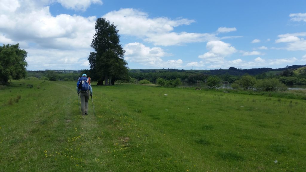
The trail then did the same thing as yesterday… we weren't on the highway, but on the hills and grass next to it. We heard others gave up on it and walked the highway because it was so swampy. We decided to give it a shot anyways. Guess what? It was swampy. And trashy. And overgrown. We persevered, though, so great is our disdain for highway walking.
After some kilometers of that frustrating feeling creeping up again (why am I mucking about in a trashy swamp several meters from a four-lane highway?), the trail finally diverted away. It followed electric fences along the river, skirting farmland and offering decent paths. There were a couple of sketchy areas, though. Electric fence is everywhere and the “trail” follows it. Where it’s not maintained you find yourself navigating interesting challenges. Today, Emily got zapped twice.

Also, the river is eroding its banks, eating away at the space between it and the fence. The picture below was what we had to swing around a couple of meters above the river. (The bank is so steep that the picture below looks like we're level with the water, but we promise we're a couple of meters above it.) We walked very carefully along this edge...

Here's a picture of what we swung around to get away from the trail and back onto solid ground.

But even still, the trail was at least decent enough to not have to plan every footstep, or make you feel that dangerous divets lurked unseen. And then it got to some great stopbank walking. Unlike yesterday’s ankle and knee twist party, though, the stopbank today was pretty good. There were a lot of stiles separating paddocks along the way. Stiles are what you use to get over the barbed wire fences, and each one is a roll of the dice on quality. Today, the numbers kept rolling in our favor.
Lunch was a mosquito party so we had the shortest lunch break of the entire trail so far. Just enough to get the food out and eat it. Then more stopbank walking. At one point, we went back to fence line walking. Through lots (and lots) of gorse. The land owners here don’t want hikers on their land so the trail walks just outside it. Of course, that means no one maintains it and so it’s overgrown with that spiky, prickly bush.
Today it did something interesting besides turn us into pin cushions, though: it was popping its seed pods out. Each time one was ejected it sounded like a crack or sharp pop. Because there were thousands of these pods all around us, it was a constant noise. It sounded very much like the bushes were on fire. For a kilometer or so it was a constant din of snap, crackle, and pop. Kind of interesting and made all the hundreds of miniature stabbings a little more tolerable. Emily is just getting ready to plow through some of the gorse bushes below.

The last part of the day featured more stopbank and then road walking into Rangiri. This part was made better by the presence of a hiker from Wales. He has done the Appalachian Trail and walks 40 km a day or so. He was ready to slow down a bit so we three walked together, swapping stories, talking about politics, and so on. We likely won’t see him again as he gets up so early. It was a fun diversion for today, though.

In Rangiriri, Cathy runs a little pie shop and lets TA walkers stay for free in her backyard. So amazing. We, of course, bought a couple of pies. She fresh made them for us… blueberry and apple… with fresh cream and sugar on the side. So delicious. So very delicious. We are going to want one every day for the rest of the trail…
While waiting for the pies to bake, we got a juice to share. I took a sip, Emily took a sip. Then one more round of that and more than half the bottle was left. A moment later, Emily reached for another sip. But the bottle was empty. I must have blacked out or something. I seriously have no recollection of drinking the juice. We both looked at the bottle like… “what? is that empty? did you (I) do that?”. I had run out of water several km before town so I was thirsty, but still…
I salvaged the situation by saying "Oops." Fortunately, Emily knows how contrary to my actions on this trip it was so we’ve been able to laugh about it. We’ll see if she lets me hold the juice anymore…
(Retrospective note: To this day, Emily and I laugh about this moment. We'll be out adventuring and she'll eye me carefully when I drink anything we're sharing and tell me she's watching me to make sure I don't have an "oops" moment. Hilarious!)
Cathy’s mom also happened to be a historian of the country. It was fascinating to hear about the “stuff they don’t tell you”. Mostly about the brutal, underhanded tactics from the British who wanted all the land. At one point, they slaughtered women and children to a point that a commanding officer later committed suicide over his feelings of regret. In case you’re wondering, they don’t have native reservations like the US. Maori own their land and have certain benefits, but there’s no dedicated places for them in the same sense.
Then it was dinner around the picnic table with our hiker friends, swapping experiences, and laughing about stupid hiker stuff.
Tomorrow will have more stopbank walking before we head up into the mountains again. May be a big day in terms of distance for us. We’ll see.