Pilot adventure to the Arctic Circle
The trip began when my co-worker, Paul Hauser, asked if I'd be interested in flying with him to Fairbanks, Alaska and stopping along the way to see various things. I can’t remember what I said exactly, but I’m sure I was polite enough to let him finish asking before I said “yes”. Paul owns a Cessna 206 that brings him untold hours of enjoyment. As for myself, I enjoy using my pilot’s license when I’m able. Unfortunately, there’s a lot of noise in small aircraft both from the engine and from the constant sucking sound of money flying out of your bank account and into the airplane. Fortunately, he has some noise canceling headphones so the engine is muffled, but I suspect he can still hear the money flying by him loud and clear.
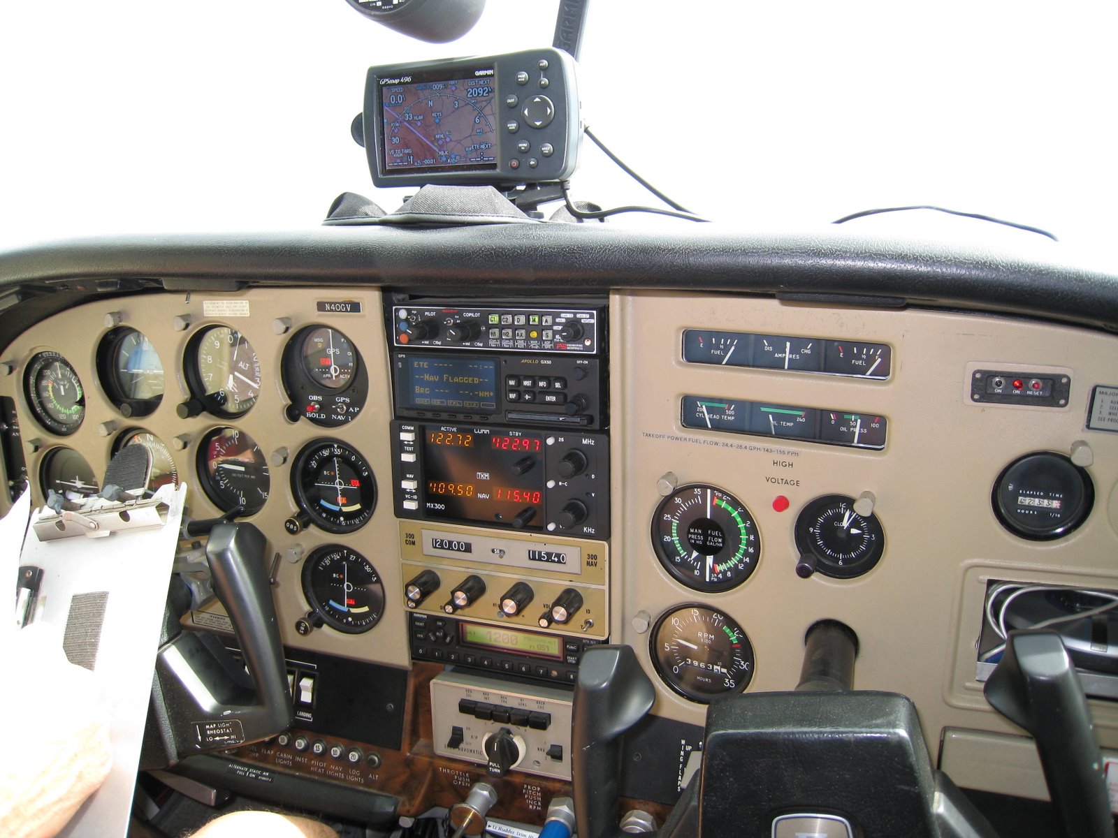
At any rate, here’s the outside and the inside of the airplane:

Our overall route was:
July 1st: Boulder, CO to Wilbur, WA
July 2nd: Wilbur, WA to Haines, AK
July 3rd: Haines, AK to McCarthy, AK
July 4th: McCarthy, AK to Fairbanks, AK
July 5th: Fairbanks to Dead Horse, AK (Prudhoe Bay on the Arctic Ocean) and back
July 6th: Fairbanks to McKinley and back
On the 7th, Paul went with some longtime friends of his on a 14 day kayaking trip down a river and into the Arctic Ocean. I stuck around until the 10th seeing as much of the area as I could in a rental car.
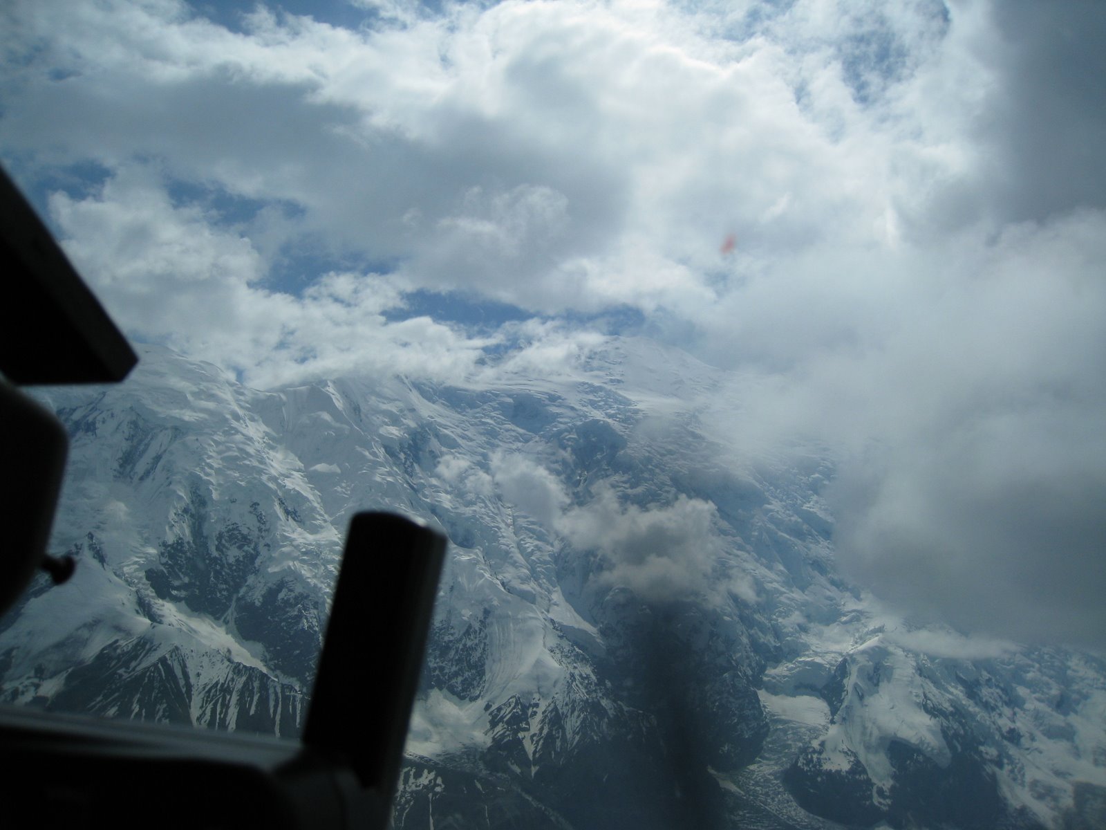
There are a number of things that made this trip memorable. First and foremost was the incredible weather we enjoyed. Everywhere we went, the locals would say something like: “This is one of the few days in the year where you could fly the route you took and see as much as you did.” Every day was like that and I feel fortunate for our once-in-a-lifetime luck. Several times, when we moved on I would hear that the place was socked in the next day with steady rain that would have kept us grounded or flying in sub-par weather. Flying to McKinley was exceptionally stirring as the clouds literally parted just long enough for us to see it in dramatic fashion, which I’ll elaborate on later.
Along with the great weather, we met some great people. Similar to my cycling trip through the heart of North America, the people we met were friendly, gracious, and helpful. We met a number of bush pilots who all seemed to know each other across the state. We ate dinner and breakfast with a family in McCarthy making a great place even better. The scenery was impressive, but I enjoyed the people more on deeper levels than I could ever appreciate piles of rocks and ice.
That being said, the scenery was awesome! I took hundreds of pictures on a new camera I bought for the occasion. A lot of the time, I put the camera down and just looked out the window. I couldn’t possibly share all the pictures or describe everything so the handful of pictures below are what I consider to be representative of my experience as they help to illustrate the story, but they should not be considered the best of what I saw or what Alaska has to offer you.
Enough preludes and disclaimers!
Our plan on day 1 was to try to get to Washington and then cross the border and through customs if there was time and good weather. I had not done extended mountain flying in a small airplane, but I had heard terrible things about turbulence, sudden bad weather, turbulence, wind shear, and about nauseating turbulence. I believe we were about as lucky as two guys could be since I don’t remember more than a few minutes of slight turbulence throughout the trip. Despite my small number of piloting hours, I’ve flown in some bad turbulence where my focus was entirely spent on keeping the wings level and being happy to stay within 500 feet of the altitude I was aiming for.
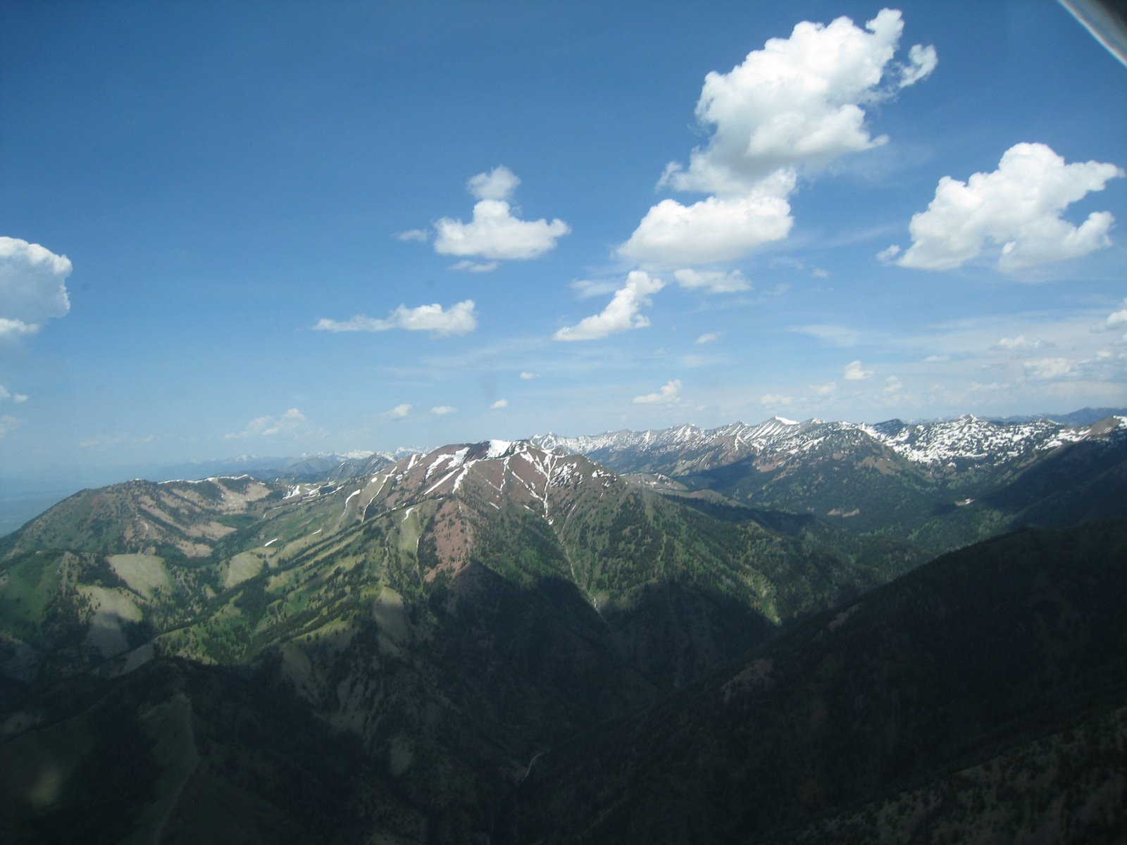
The next picture shows a mountain range somewhere between Boulder and Idaho Falls. I took the picture because I liked the way the greens, whites and reds worked together.
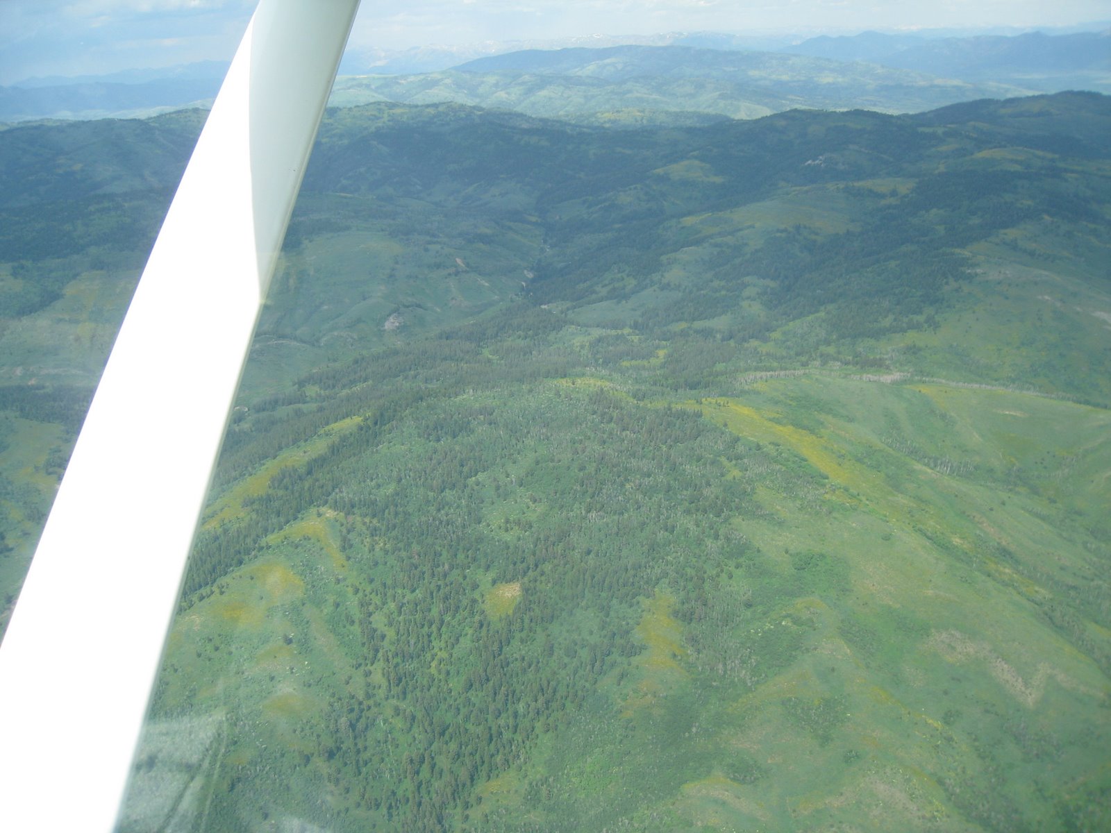
Next up is a set of rolling mountains with large fields of wildflowers scattered about. This is a representative picture as we passed swaths of wildflowers much larger than those seen below, but it was easier to see the yellow flowers in this picture than the blues or purples in many of the others.
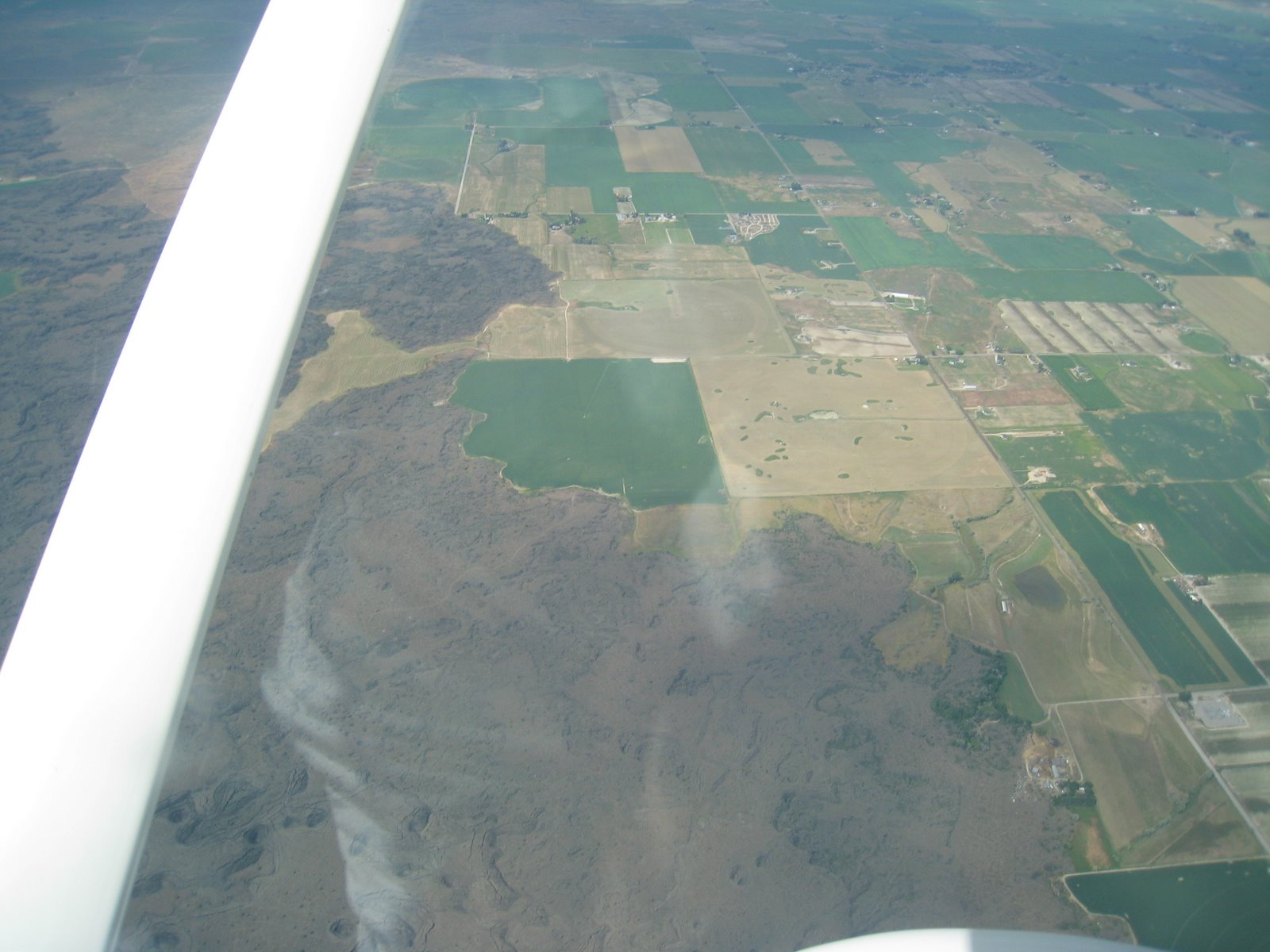
This picture was taken just outside of Idaho Falls. I was fascinated by the way the farmlands butted up against the old lava flows. The lava looked to me like a dynamic, living entity ready to swallow the entire valley.
I believe the next picture is while we were still in Idaho on our way to Washington. I remember being impressed by all the cragged peaks covered by snow banks, occasional glaciers, and the high alpine lakes.
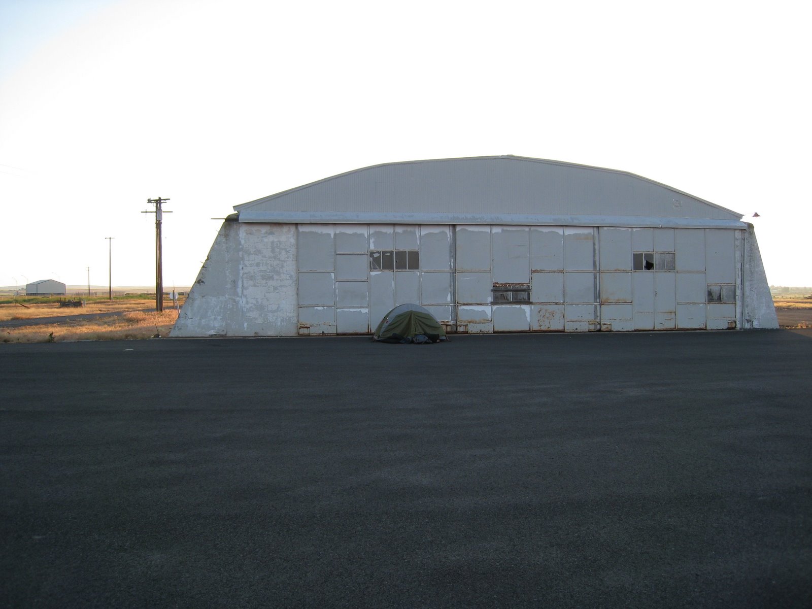
The weather turned sketchy at the Washington/Canada border so we decided to call it a day in Wilbur, WA. I’m sure the population was measured in the hundreds, but they did have three(!) small restaurants. We biked the mile or two into town with the mountain bikes we crammed into the airplane. Biking along a small highway in the middle of nowhere made me feel like I was back on the road again with my friends from my cycling tour and I was feeling nostalgic… If any of the TX 4000 alumni are reading this then I tip my hat in your direction. At any rate, one of the great things about small town airports is that you’re more than welcome to pitch a tent anywhere you feel is suitable. As seen below, I picked a spot in front of an old WW II hangar. Another great thing about these small airports is the friendly people you meet. The pilot who flies a crop duster out of the airport saw us from his house and he stopped by several times offering to help. He even offered us his shiny new diesel truck as a temporary loaner for the night!
The next morning, the weather north of us was looking excellent so we made our way across the border where this next picture was taken. If anybody is interested in crossing illegally into Canada I can testify that the border is as open as it could possibly be and is as easy as taking any of the many, many logging roads that cross around. When you want to cross legally as a pilot, though, you’re given a 15 minute window of when you’re allowed to show up and you can never show up early. For instance, if you say you’ll land at 9 AM and you show up at 8:55 that's a no-go. You can land between 9 AM and 9:15 AM and heaven help you if you want to turn back or extend your time. The US customs people can be particularly strict and there’s all sorts of paperwork and hoops you’ll have to jump through. Why they should make things so difficult for the people who are trying to be honest and compliant while they make it easy for illegal traffic is a mystery.
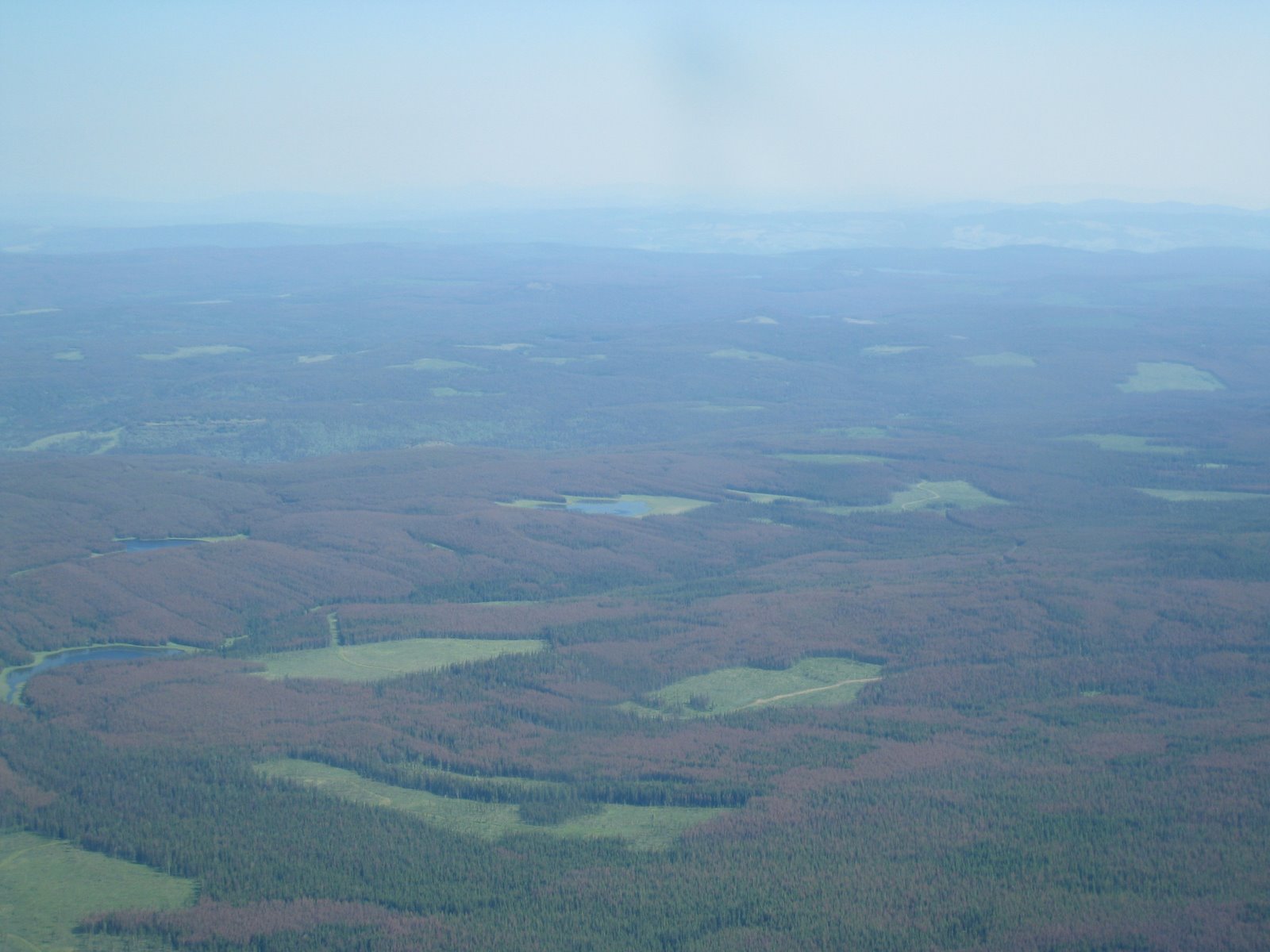
I show the next picture for a few of reasons. The first is the haziness from wildfires. We suspected the haze was from the California fires, but there were a number of smaller fires around the larger area as well. The weather was awesome, but sometimes the horizon was obscured by the smoke. The second reason I show this picture is to highlight the destruction of the forests by pine beetles. They’re just little beetles that burrow into the bark of the tree and lay their eggs which later hatch and eat some of the tree eventually killing it and turning it a red/purple color. A harsh winter keeps their numbers manageable, but a string of relatively warm winters has them destroying millions of pine trees. We saw huge swaths of destruction for as far as the eye could see from Boulder to most of the way to Fairbanks. And speaking of destruction, the third reason I show the picture below is for the logging patterns you can see when you’re in the air. Around the main highways there was a large buffer zone so it looks like you’re driving through a densely forested, untouched wilderness, but from above you could see large patches cut out. The picture below is pretty tame in this respect considering some areas we saw had more holes in the forest than trees.
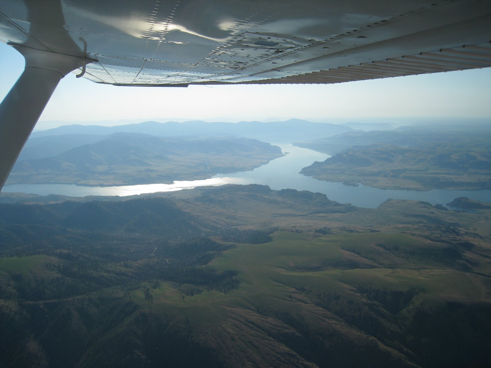
The next pictures are of Burns Lake (I think) and Smithers, British Columbia. I show them because they were part of my bike tour. We cycled on the road in the first picture that runs diagonal across the image and ended up coming into Smithers on the road in the second picture that comes from the bottom of the screen. That day on the bike was miserably cold and rainy, something like 105 miles (it started before Burns Lake) and it took hours and hours. Flying from Burns Lake to Smithers took ten minutes and was clear and sunny. Probably interesting only to me.
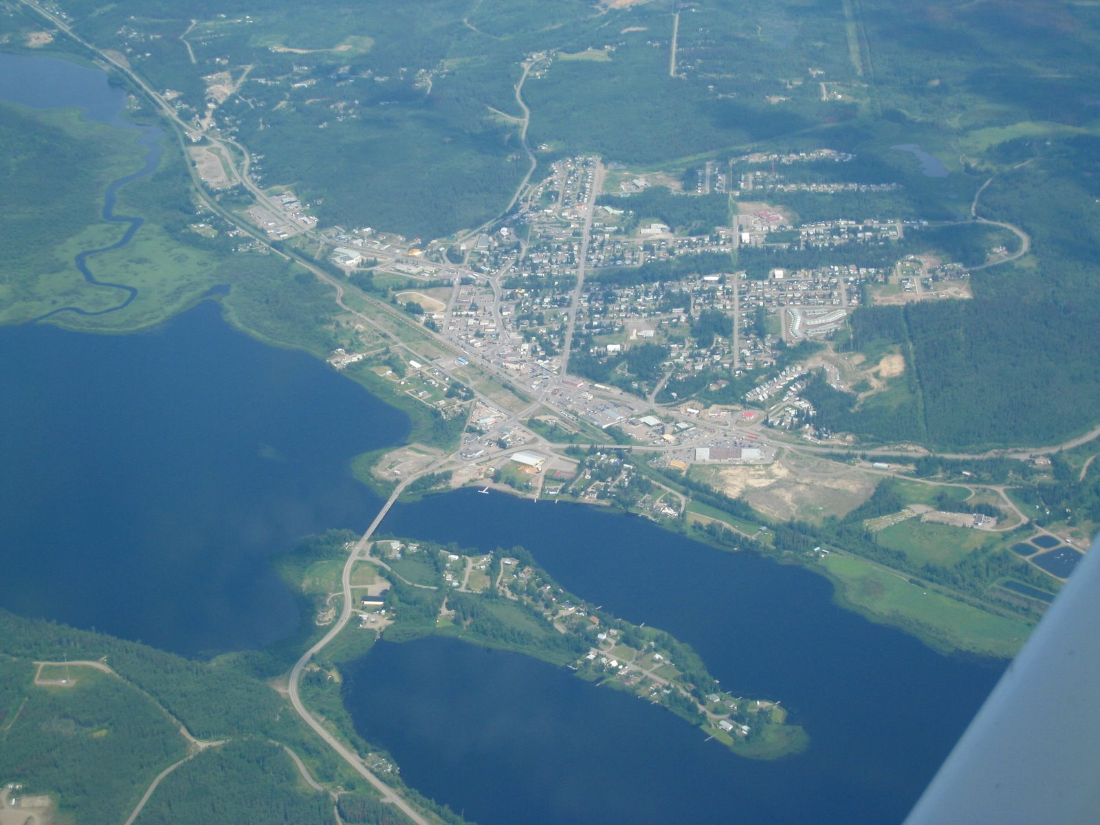
In the picture above, you can see that great mountain they have rising above their town and the glacier that flows from it. After fueling up at their surprisingly large airport, we went just to the right of that mountain and very soon we were flying over this:
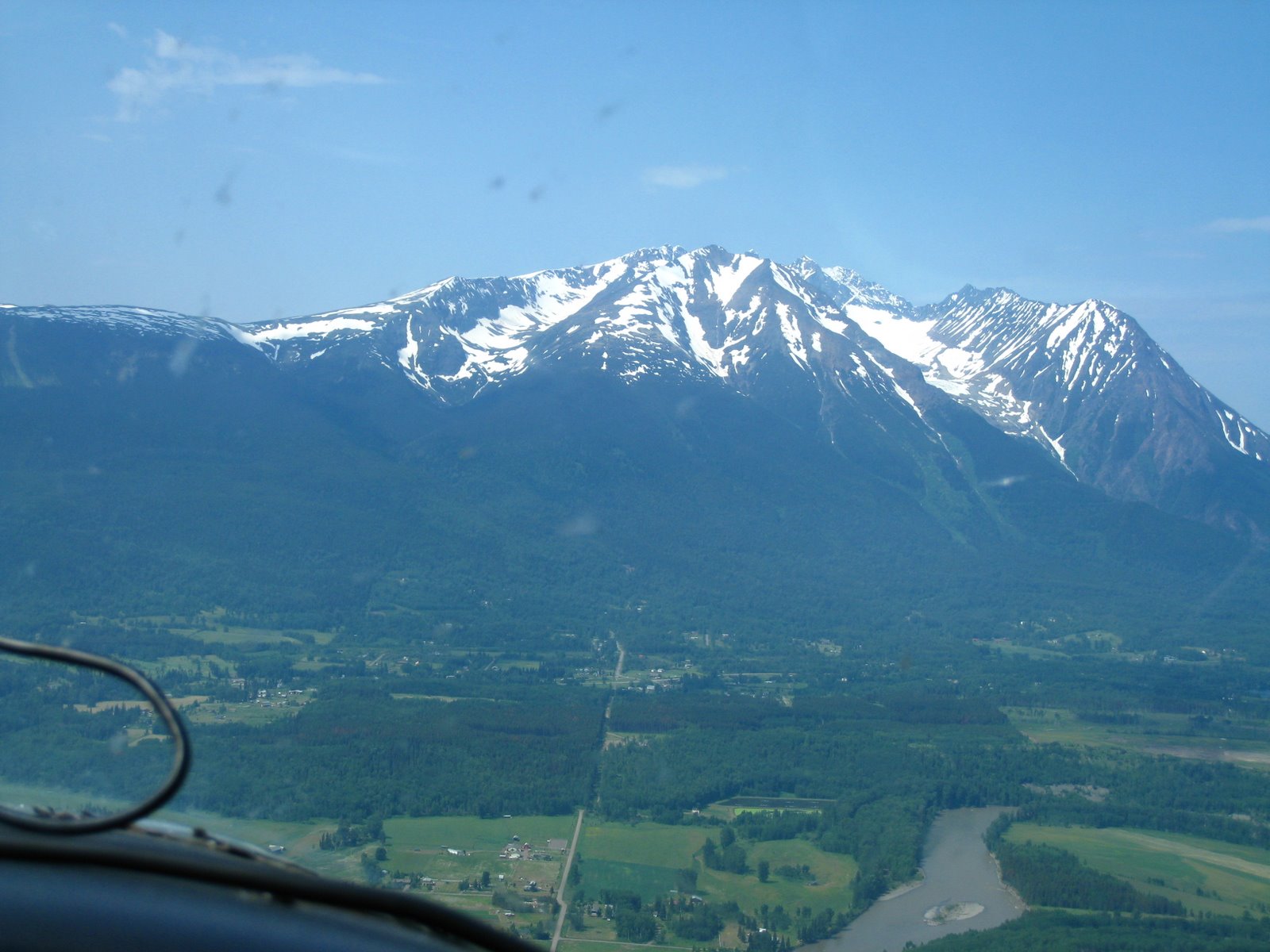
It’s surprising how fast the climate changes! I took a small nap in Smithers while waiting on Paul to check the weather ahead and it was hot! Very toasty indeed lying in the sun, but just a fifteen minute flight at relatively slow speeds and you’re in a lot of trouble if you had to land and hoof it out on foot.
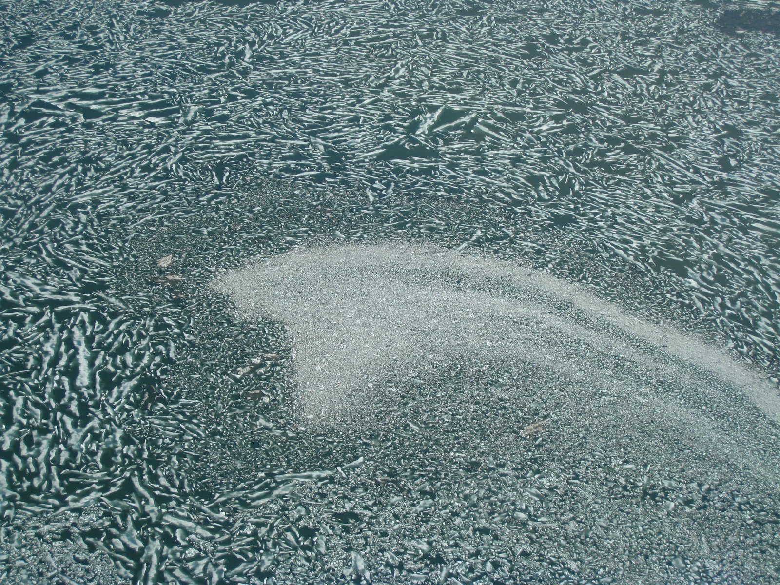
The next group of pictures are of the icy terrain we flew across on our way to Wrangell, Alaska for fuel.
You can see the terrain dramatically changing again in the above picture as it moves from glaciers and ice capped mountains to a lush green valley within one snapshot. Not very far from this point, I took the picture below of a hanging lake feeding a series of waterfalls into another lake.

Another example of how fervently life clings to every nook and cranny. I captured it poorly in the photo below, but I was trying to show a massive green river valley leading to a large pine forest on the edge of a silt clogged river basin flowing from heavily glaciered peaks densely covered by pine trees and anything else that doesn’t freeze in the winter. It’s hard to make it out from this picture, but the pines trees on all of the mountains up there come within inches of the boundary for life.
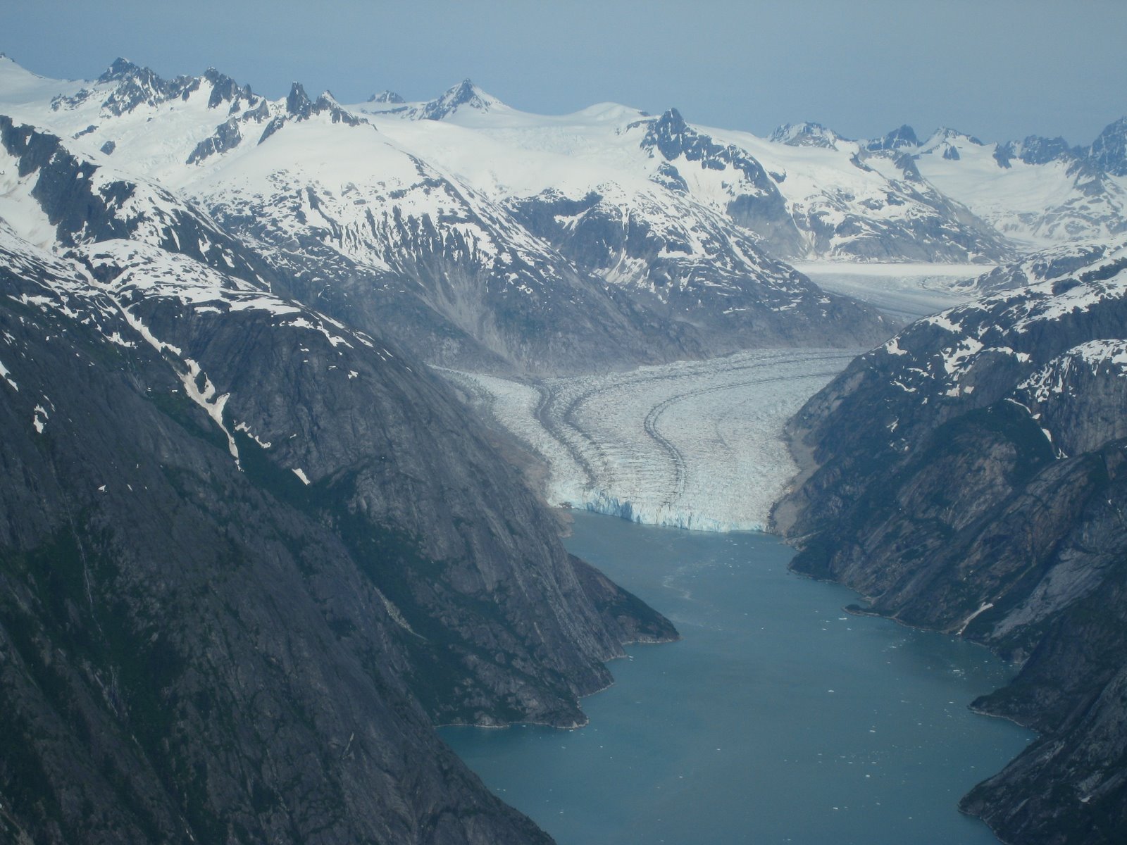
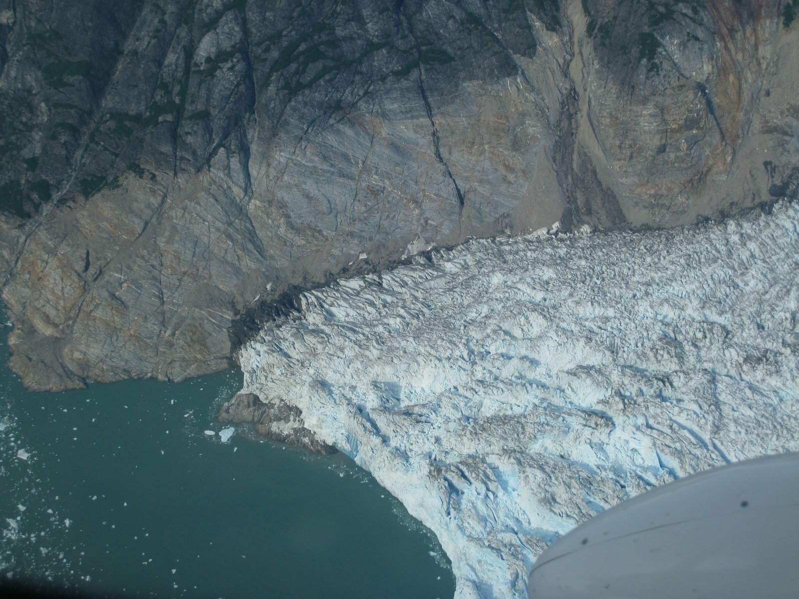
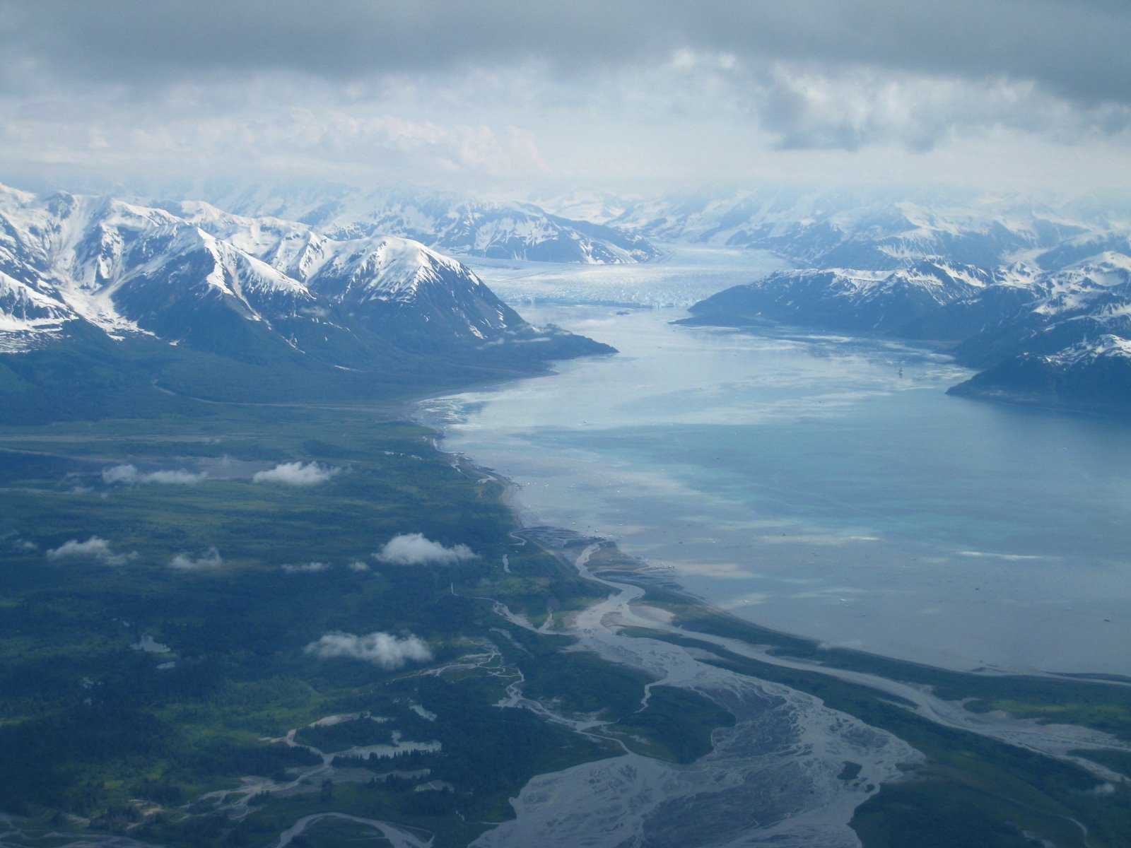
Below was the first time I had seen a glacier break directly into the fjords and create icebergs. At this point, we were very close to the inside passage that I’ve wanted to book a cruise through.
Just a little bit further on and we came across another glacier/fjord combination.
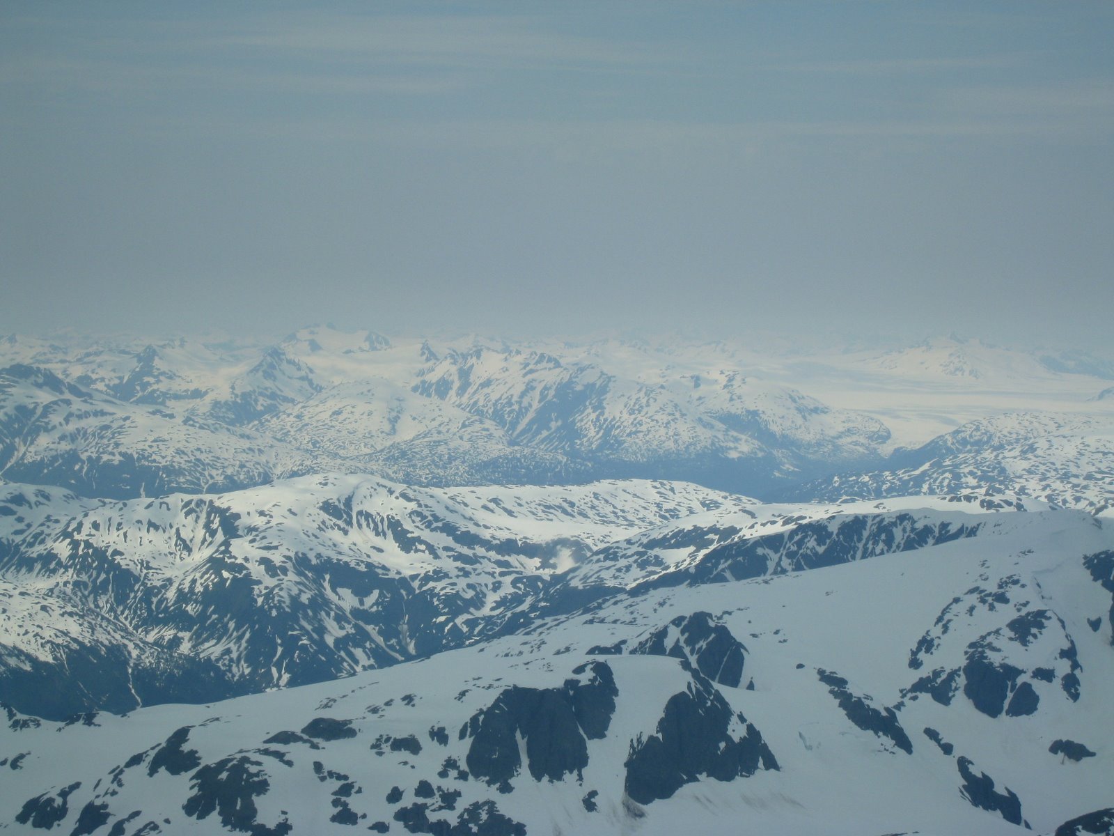
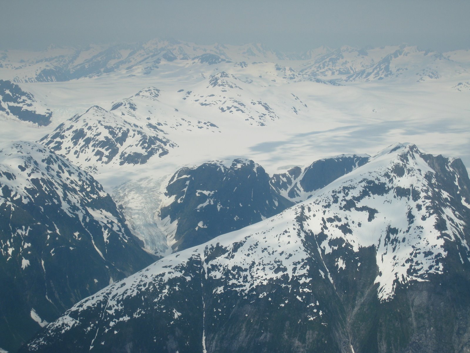
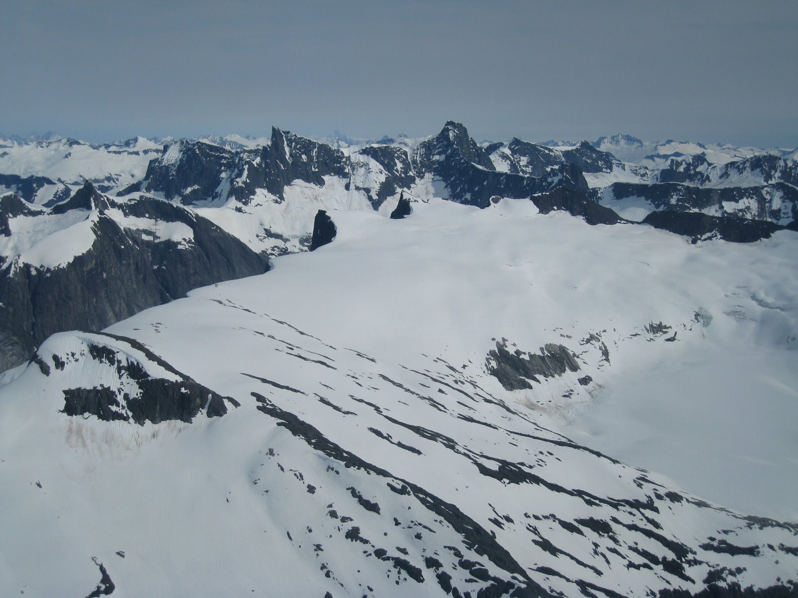
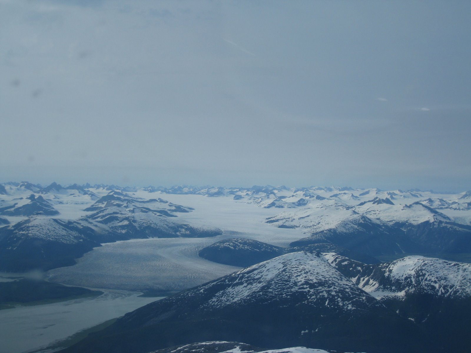
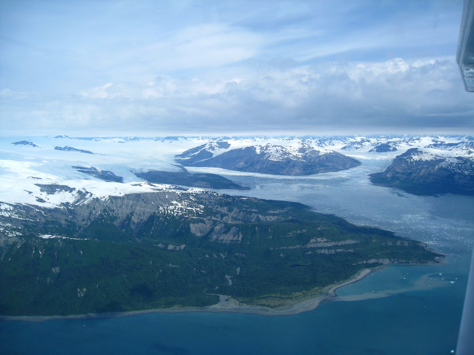
We ended up checking out the large ice field above the inside passage leading to Juneau where I snapped the next two pictures of the immense fields of ice and snow. The pictures don’t do justice to the feeling I had of being in a truly alien world. Besides the impressively jagged peaks, there were cliffs thousands of feet tall that plummeted into fjords or massive valleys of ice.
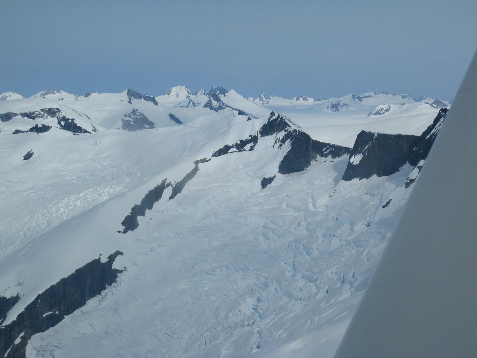
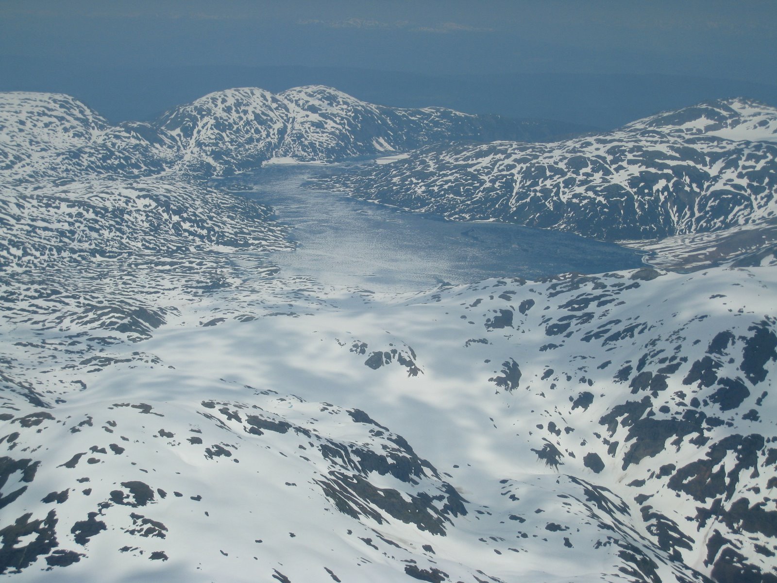
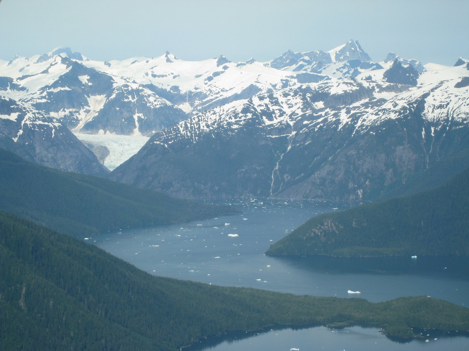
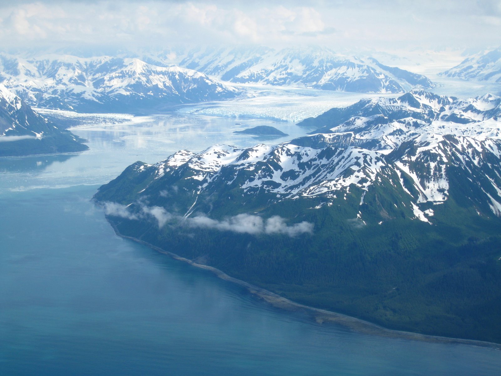
Some more pictures of glaciers and fjords.
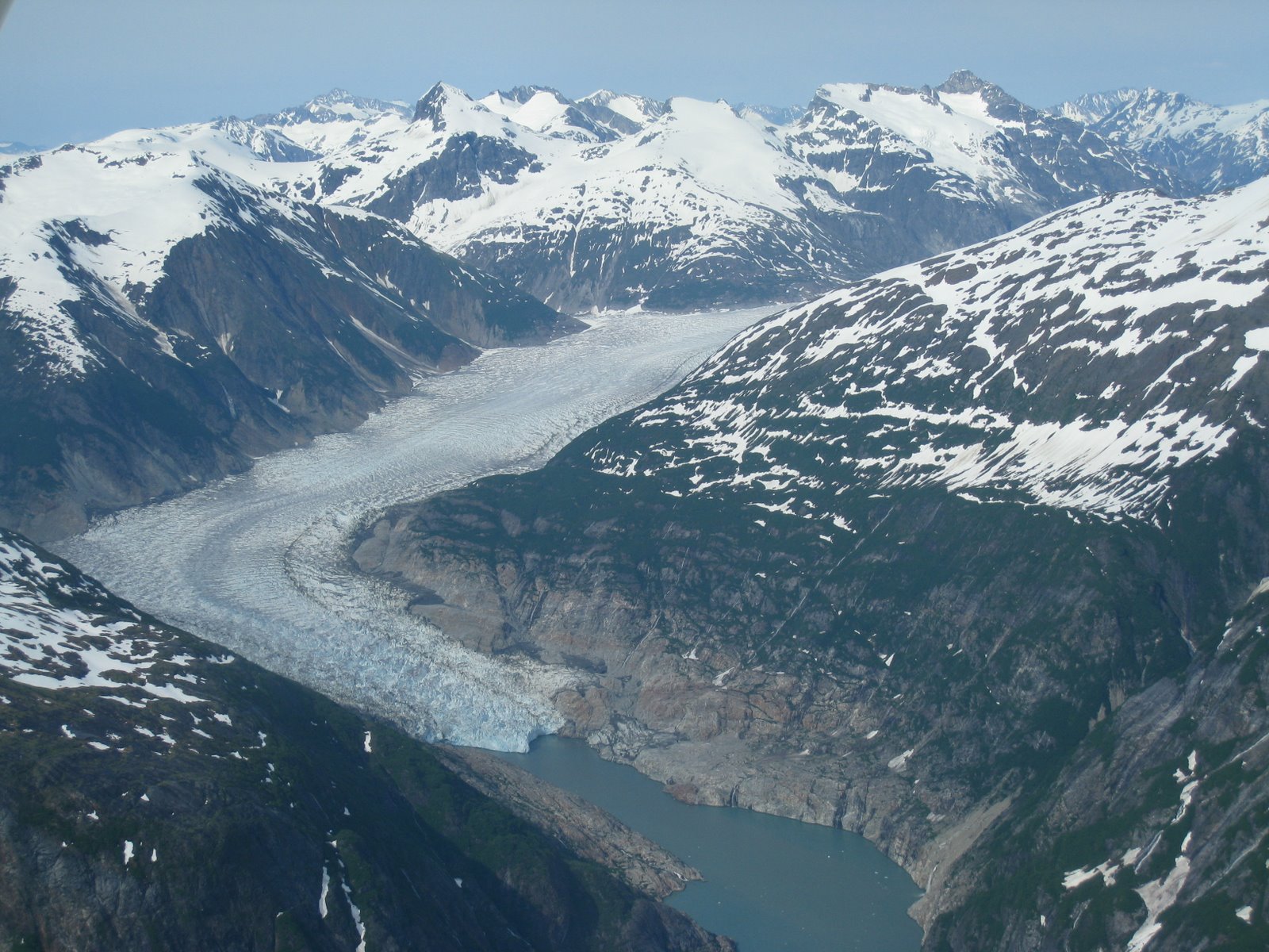
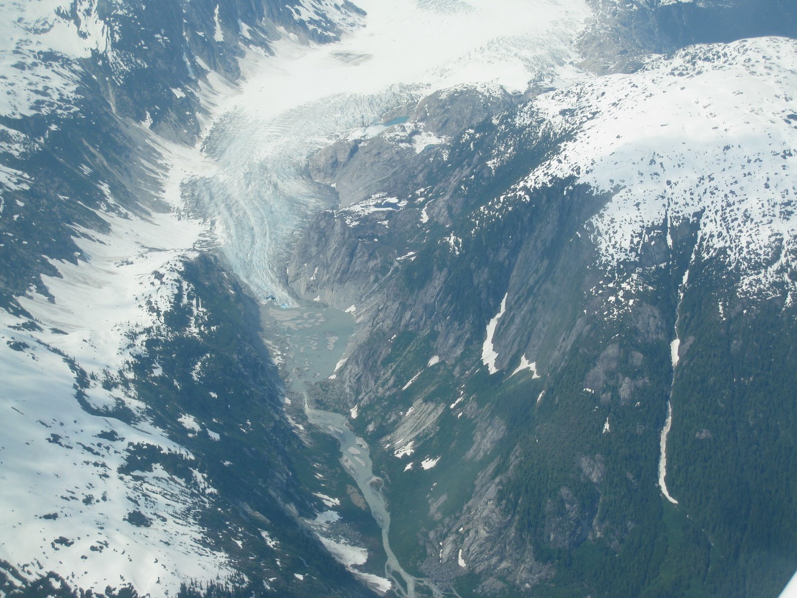
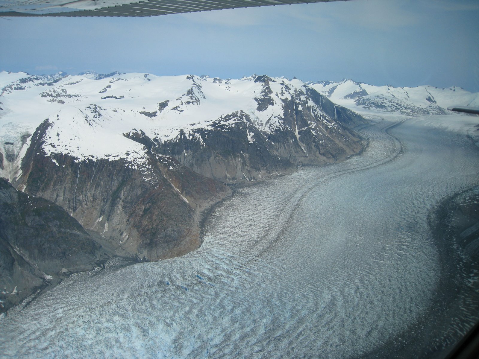
The next pictures is of a truly impressive glacier. I tried to capture how magnificent the breadth of its terminal area was, but the pictures make it look smaller than it really is. It looks large in the pictures (I found using a pine tree as a comparative guide was useful), but that still seems to fall short of the impression I had of flying over it.
Another shot of thick ice eating up most of the mountains.

I like the picture below because on one side of the mountain you have tons of crushing ice in a barren eternal winter wasteland and on the other a side a verdant green river valley.

The next two pictures are of the same glacier, but they turned out pretty well. There was a thin layer of ice that reflected the mountains and sunlight making things look spectacular. This whole area was filled with incredible vistas which caused me to put my camera down and just look out the window in wonderment. If you look closely, you can see one of those large cruise ships close to the glacier terminal. (In the first picture it’s the little black line just above the green island near the end of the ice)
A little while later, I picked up the camera again and captured another mountain reflected in the sea ice. The water color didn’t come through to well, but in person it was a vivid turquoise color.


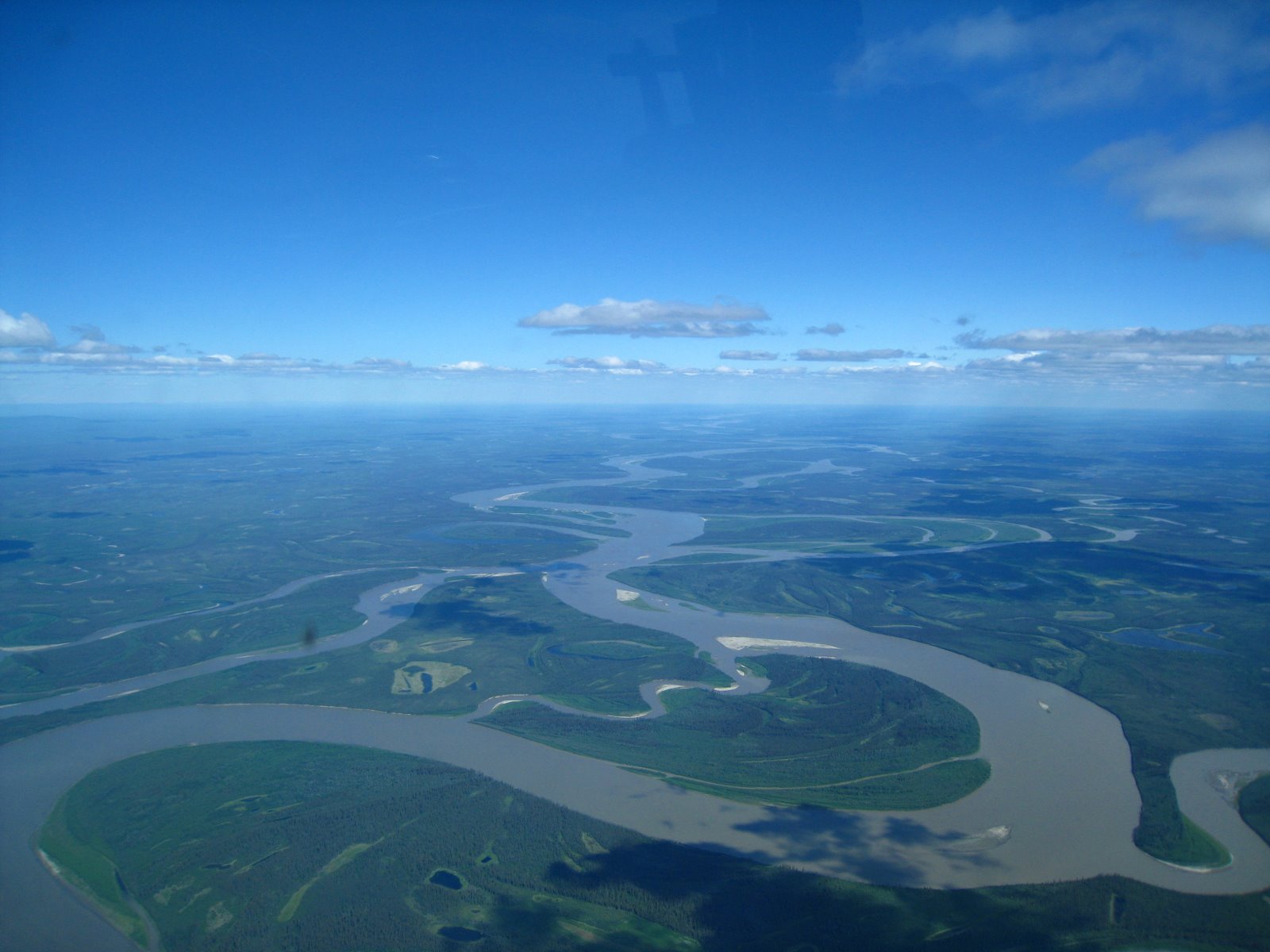
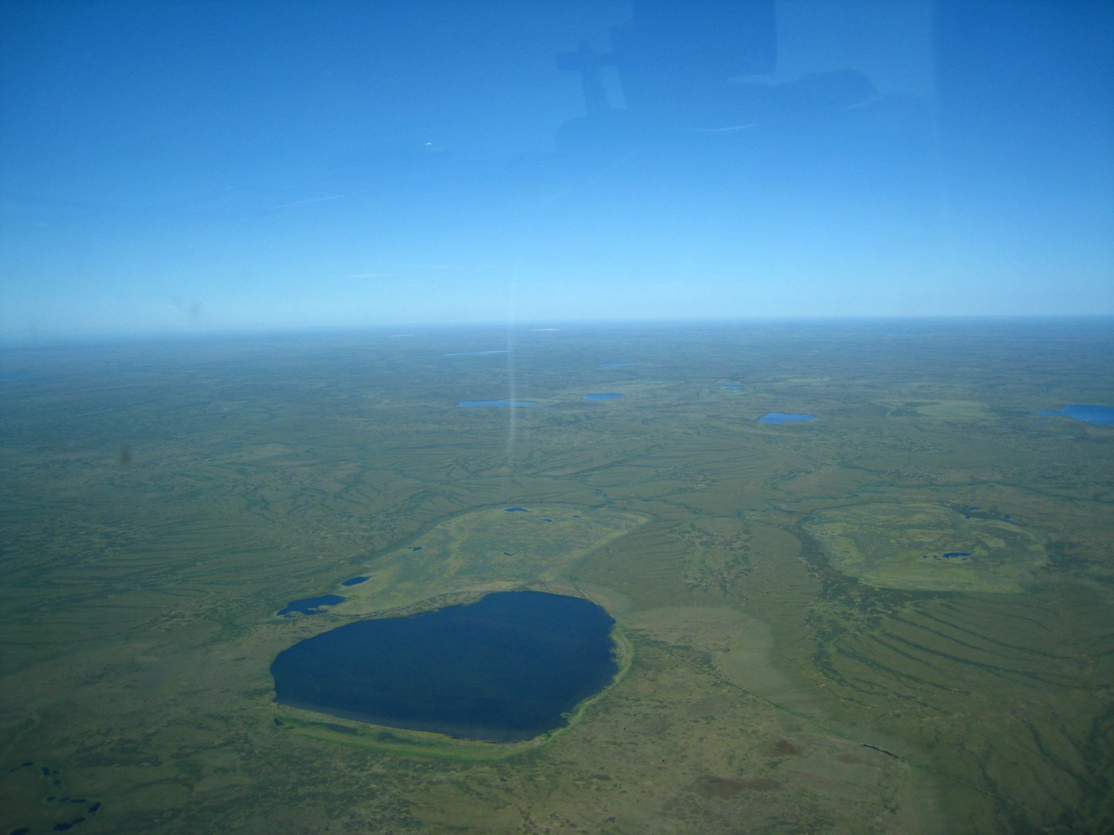
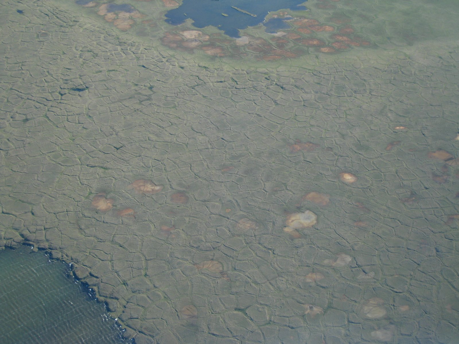
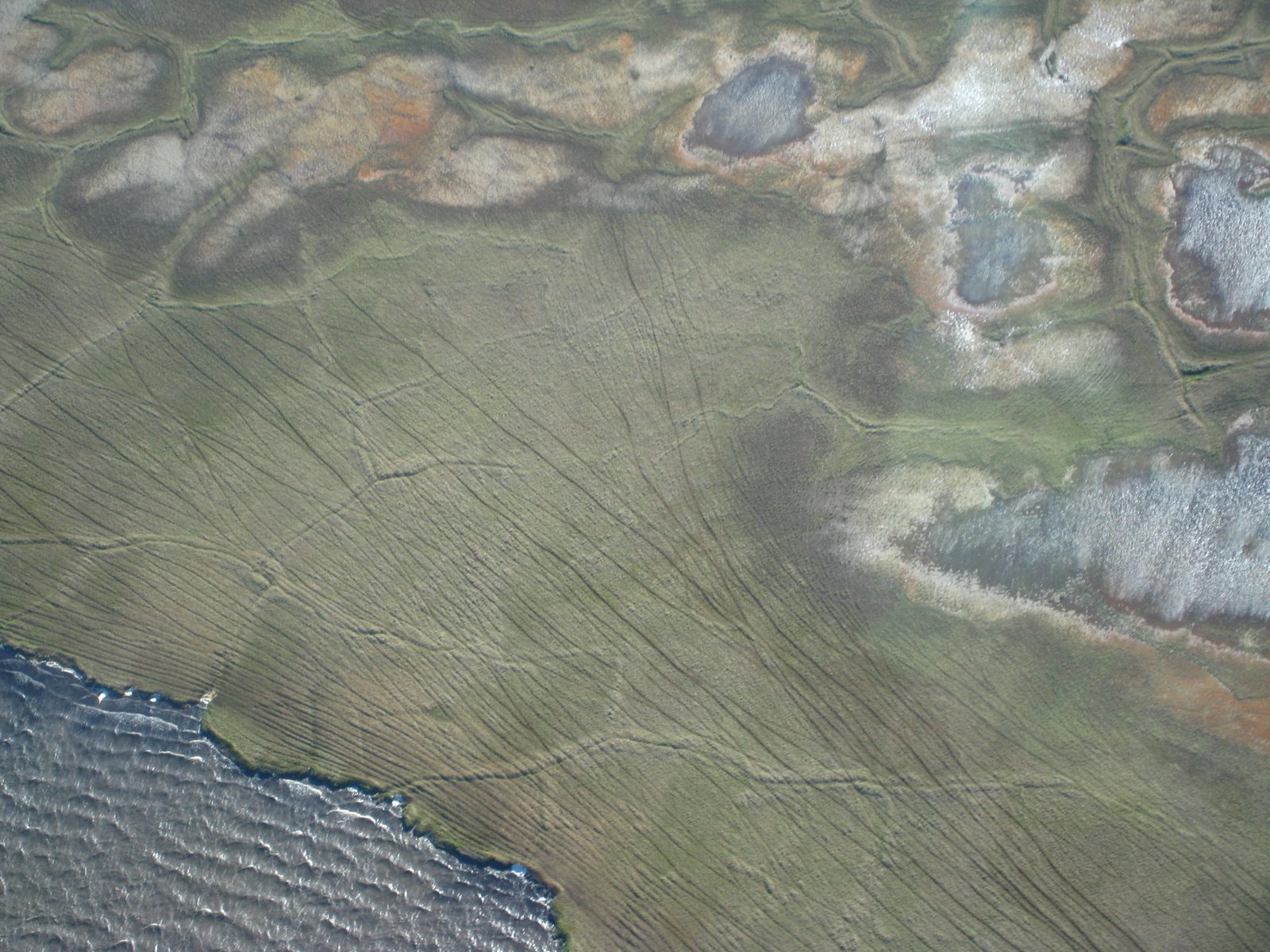
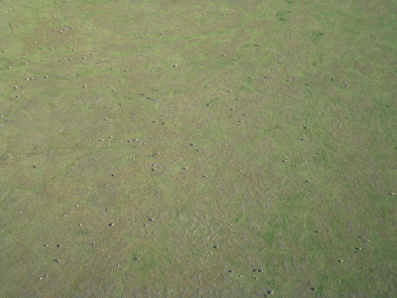
Truthfully, there’s not a lot to look at north of Fairbanks after the spectacular Inside Passage. Once in a while you would see a river snaking its way around the plains.
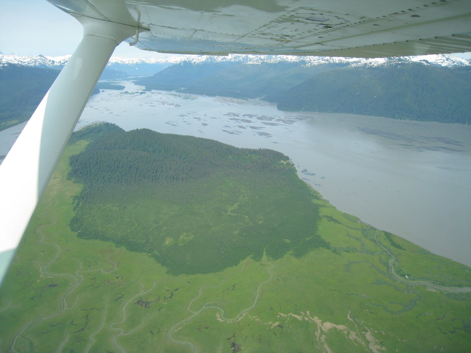
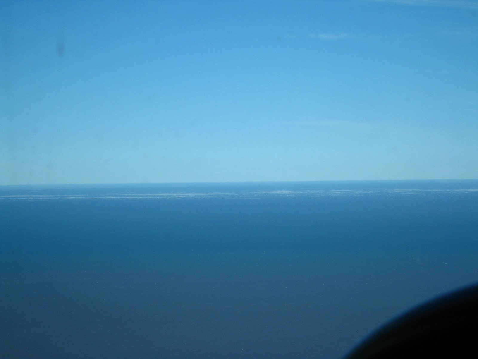
At any rate, we made it up to Dead Horse, which is actually where the picture of Paul’s plane was taken in picture #1 at the top of this posting. We spent a little bit of time walking around the “town”, spoke with the guy who runs the airport operations to get a feel for the area, and then got out of Dodge, so to speak. Just out of town, we headed along the coast and saw the edge of the arctic ice shelf on the horizon:

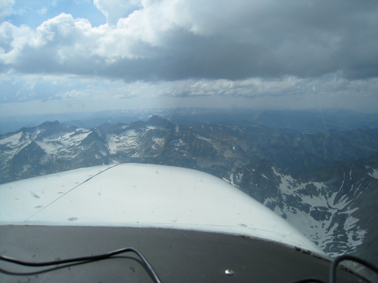
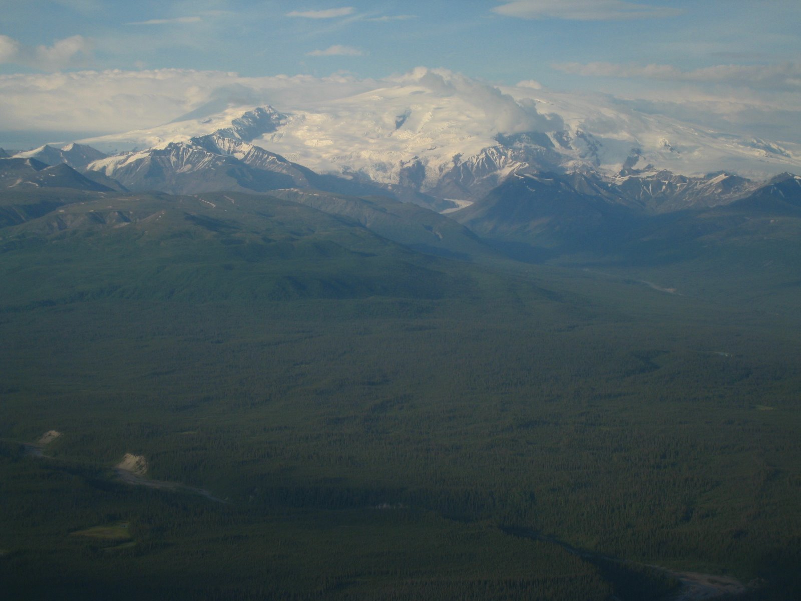
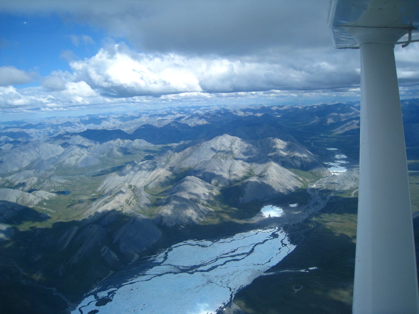
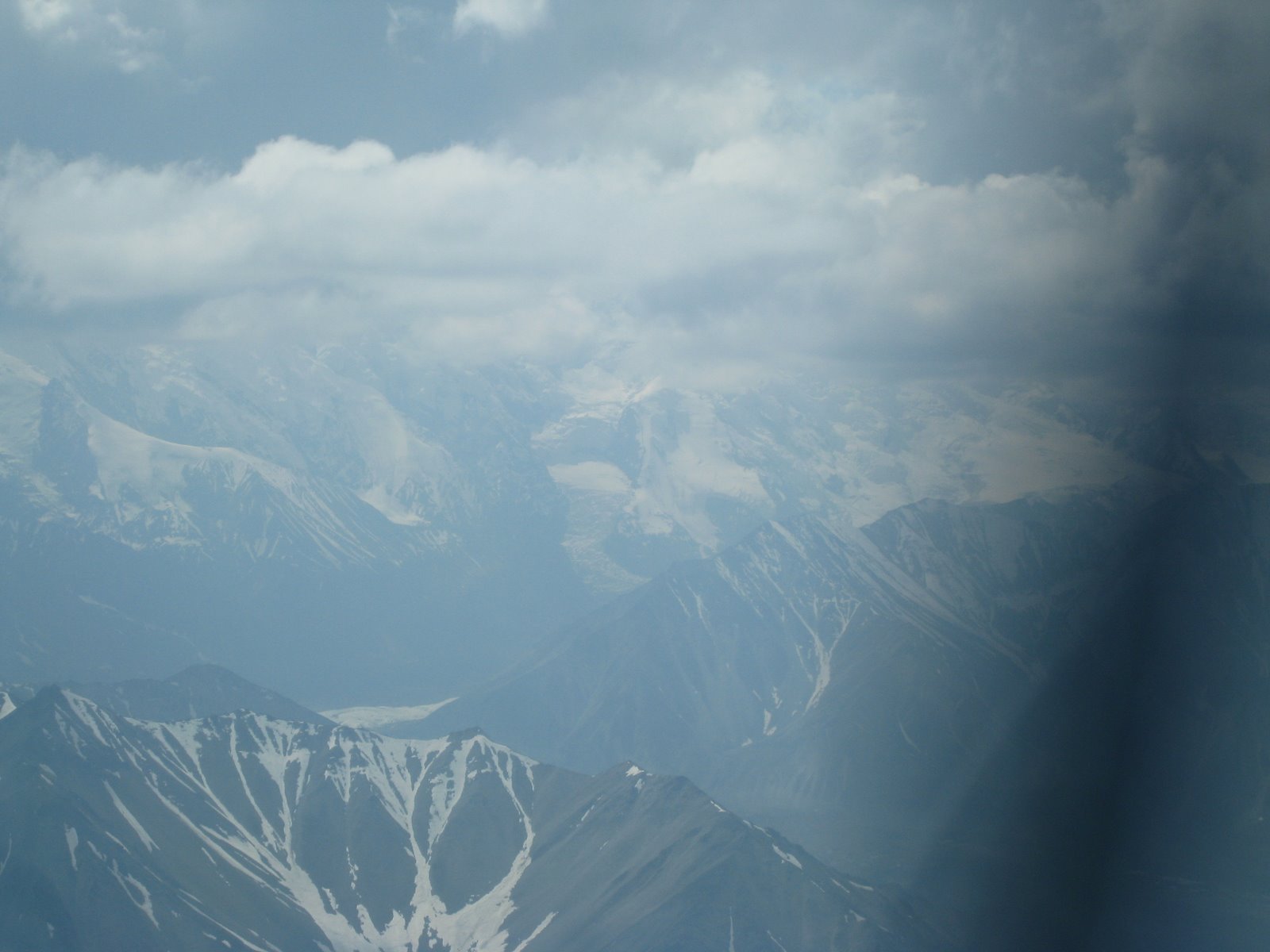
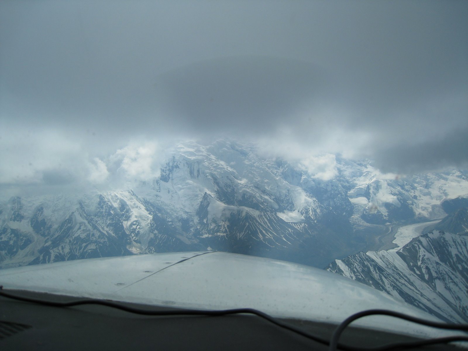
We made the trip to Denali the next day. The weather briefer told us the weather would be pretty good, but as we approached we flew through some rain and the peak was obscured. I thought our lucky weather streak may have ended. In the next three pictures, you can see what happened as we approached the mountain. The first picture shows the tall mountains that are actually ‘foothills’. I don’t know how tall they are, but I’d guess several thousand feet. It was a little intimidating because we knew the foothills were tall, we were fairly high above them and there was still a huge ice wall in front of us that we couldn’t see the top of.

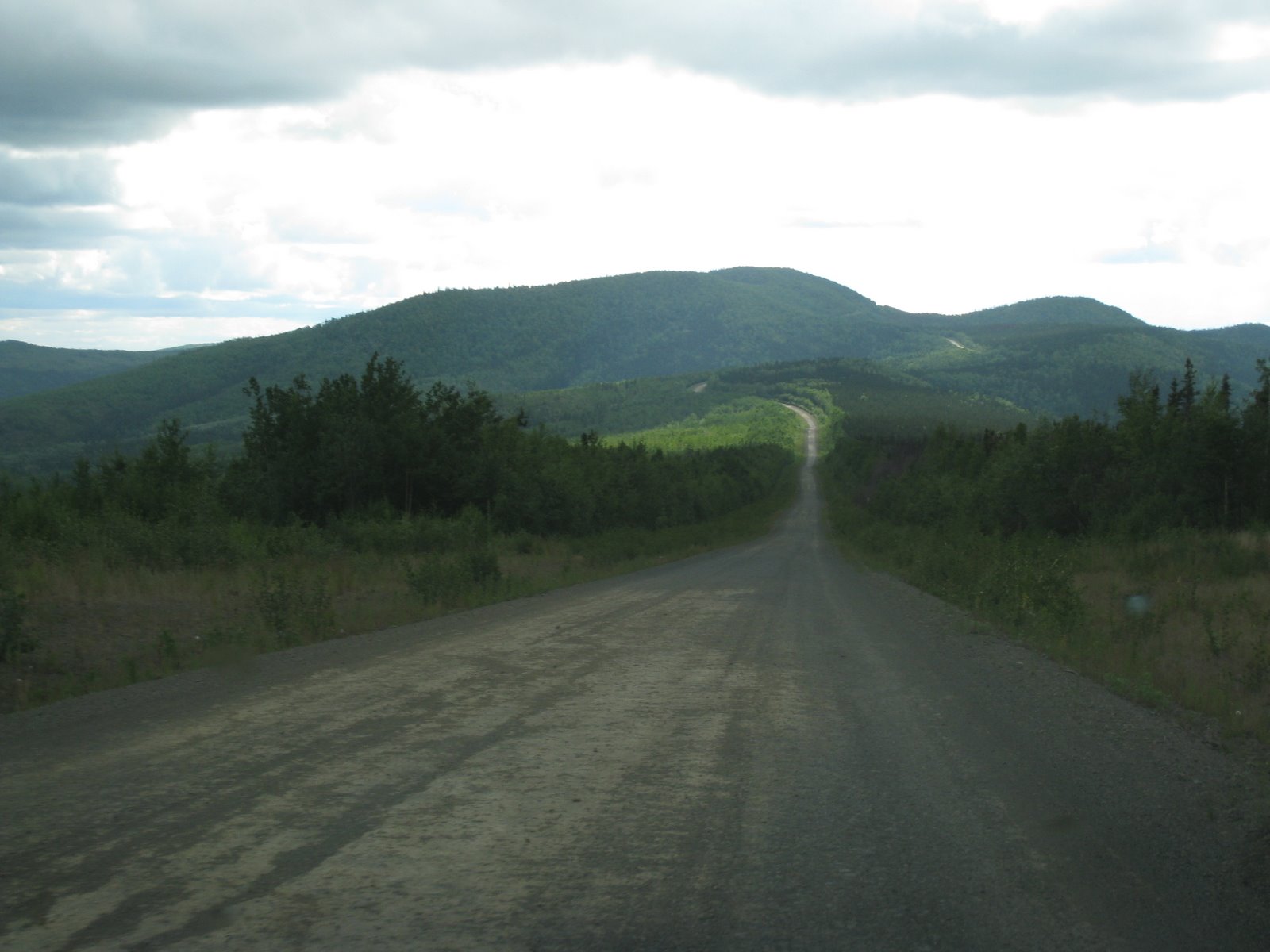
The most exciting part of that trip was the drive back the next morning. Their one fuel pump wasn’t supposed to be turned on again until later in the day, but I was supposed to meet the young woman in Fairbanks earlier. I had left Fairbanks with a full tank of gas and it had taken me more than half of the tank to get to Manley. Hmm…
I decided to be adventurous and struck out early AM to see where I’d end up. The dirt road was socked in with fog. There were parts where I couldn’t see five feet in front of me and I was doing 40 mph around these corners. I also noticed that it must not be a great place to live because the rabbits (hundreds and hundreds of them) were suicidal maniacs. I don't think I hit any of them, but not for their lack of trying.
The gas light came on about halfway back and I started feeling a little anxious. By my estimates, the highway was still 50 miles away and gas another 30 beyond that. I figured tI could walk at least 20 miles in a day so I was starting to plan my next couple of days…
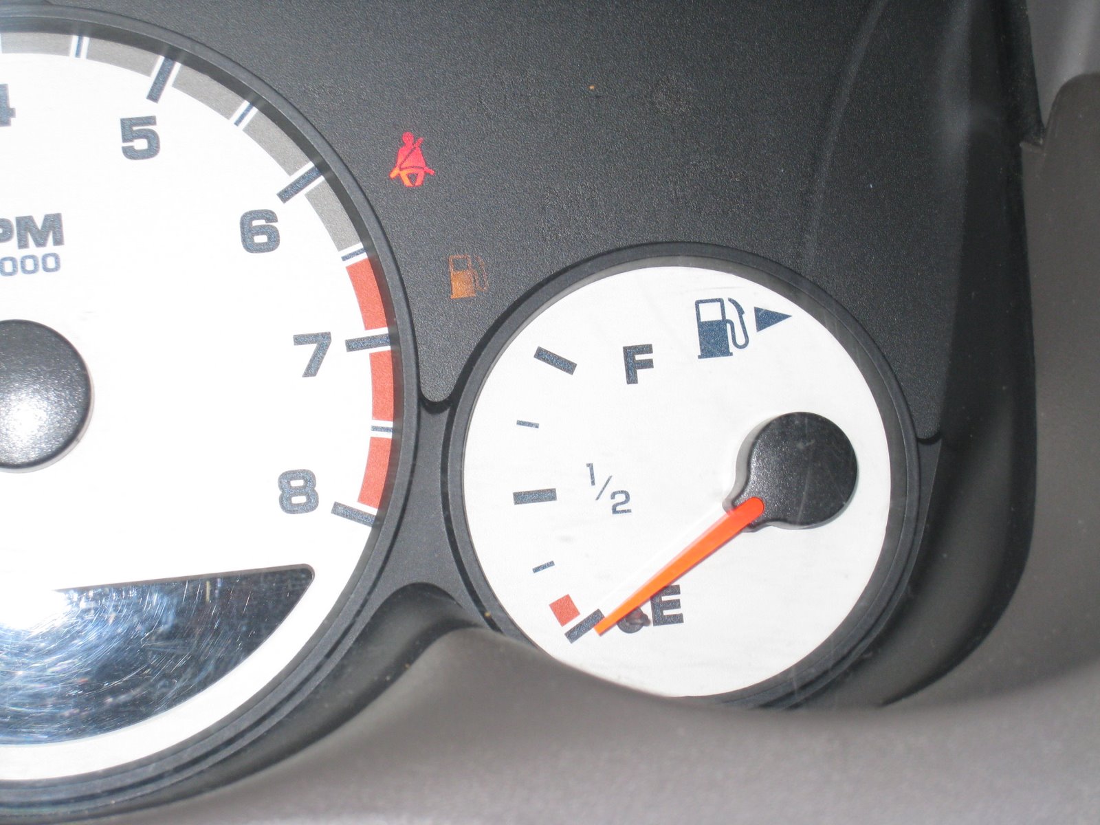
I also started pulling every gas sipping strategy in the book including driving 40 mph, going into neutral on down hills and, when I could see around the corner, I would drive in the oncoming traffic lane if it would make a shorter route. I still didn’t think I was going to make it and I thought “what I really need is a semi to draft behind.” And around the next corner, lo and behold, there was a logging truck plodding down the highway. I pulled right up behind him and tailgated, which I suspect raised my fuel efficiency close to 50 or 60 mpg. I apologize to the truck driver. I did make it to the gas station and here’s where the needle was when I pulled up to the pump:
So the trip to Alaska was memorable on a lot of levels. I have about 550 pictures so I hope you got a flavor of Alaska with what I chose. Again, the best part of these trips for me are the people. In my experience you can’t really go wrong wherever you go once you get outside the big cities when it comes to the people. But, if you’re in it for the people and the scenery (or maybe just the scenery) then Alaska is the place to be.